I recently downloaded the pro edition of the cool “Geoforager” app. It has a “probability of morels” overlay (on top of 2025 burns and other features) designed to predict where you are most likely intended to find burn morels. But does that work? Read on.
This week I traveled to one of those spots, about a 4-hour journey south then east from my home on the northwestern slopes of America’s most famous volcano to a beautiful spot in the wilderness about 10 or 15 miles due east of Mt. Rainier, called Bumping Lake. I wilderness-camped an hour outside of cellphone range in a lovely spot on the Bumping River, then hiked the highest-probably places in the August 2025 burn area north of Bumping River and Lake.
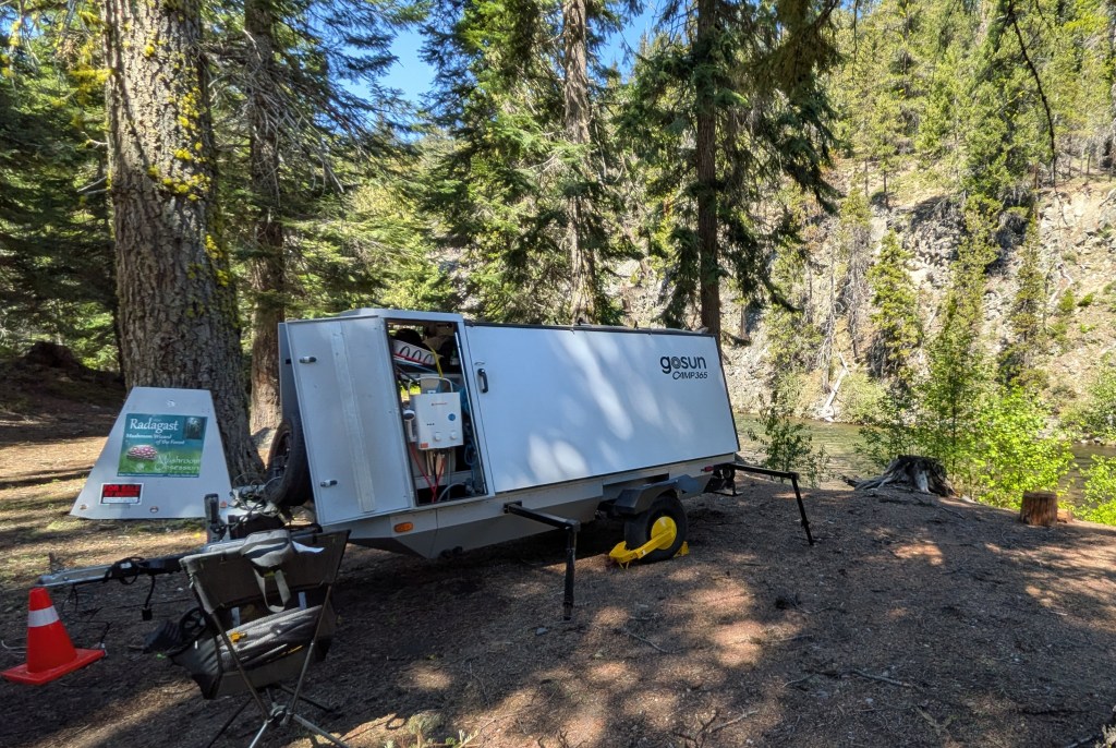
I deployed Radagast, my GoSun Camp365 trailer, in a lovely off-grid spot overlooking the Bumping River.
Travel on forest roads and hiking up trails was difficult and hazardous due to the many fallen trees from the burn. And while the location seemed perfect for morels, I didn’t find a single one. Which supported my presupposition that I was already a month too late into the season. But I did enjoy watching the F-15s doing their training runs up the canyon (just a few hundred feet above my camp site, the noise terrifyingly deafening), and also taking pictures of the gorgeous scenery, attached. (The campfire smoke which can be seen in the photo taken from the ridge high above Bumping River is from my sole neighbor in the rustic Bumping Crossing camp site.)
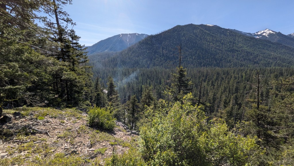
The August 2025 burn that occurred on the ridge overlooking the Bumping River and Bumping Lake was supposed to be prime morel probability. But I was a month too late. However, the view from here was fantastic, with snow-laden peaks in the distance. The smoke you can see in the center of the photo was generated by a campfire attended by my solo neighbor in the Bumping Crossing rustic campground.
One learning is that the Geoforager app doesn’t really give accurate morel probability predictions when the season is past. You still have to be aware of the ideal time to hunt.
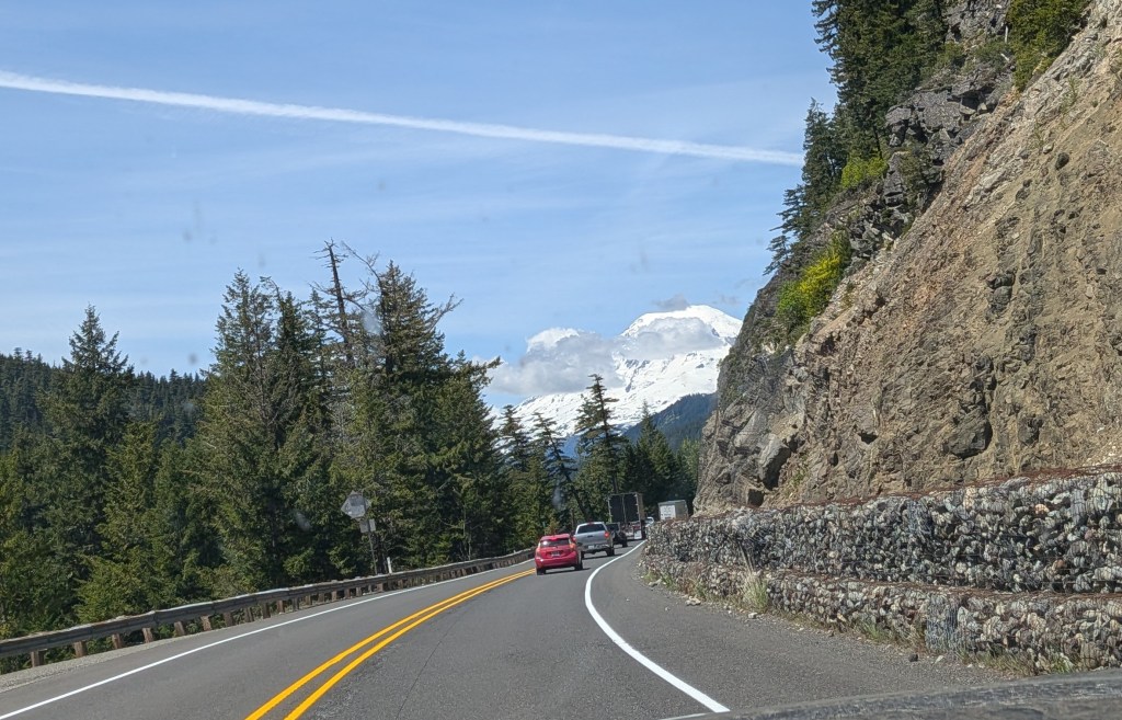
The ride homeward across White Pass was dominated by a spectacular view of Mt. Rainier from the east.
On the way home I stopped at my usual hunting grounds in the Gifford Pinchot forest, not expecting much. I did find what I thought was a nice patch of Fly Agaric. These are technically toxic due to a hallucinogenic compound, and not recommended by me, but I have double-boiled off the toxins before which left the mushrooms themselves edible.
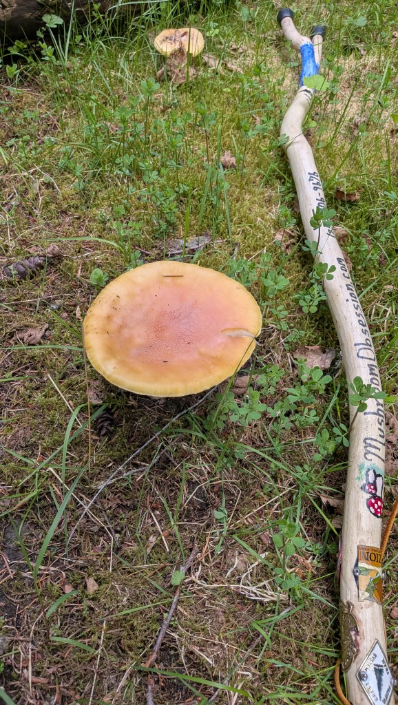
Front and center in this photo is a pretty mushroom initially identified by the Seek app as a “Fly Agaric,” but it later changed its mind and called it a “Sunshine Amanita” … probably due to its lack of white spots. Fly Agaric can be safely eaten if double boiled, but the Sunshine Amanita is deadly poisonous.
But something interesting happened this time. The two mushroom photos on this post show what appear to be immature (not yet red) Fly Agaric surrounding a large version of the same mushroom without spots. My Seek app (very useful) first identified this as a Fly Agaric, then changed its mind and said it was a “Sunshine Amanita.”
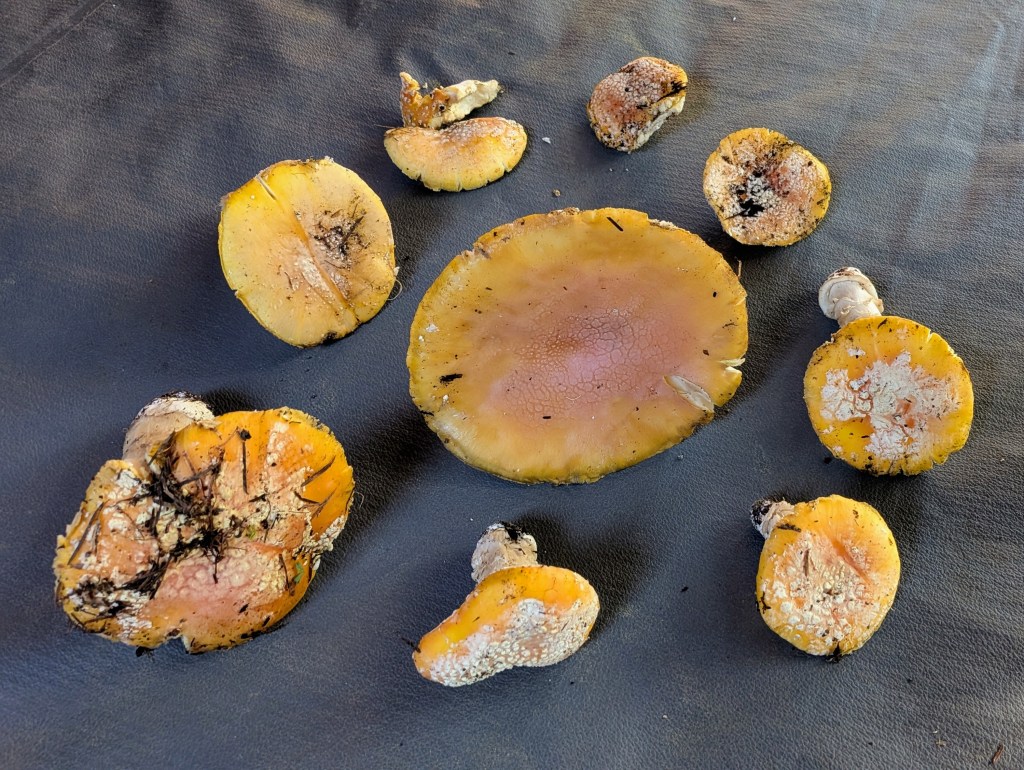
Sunshine Amanita (center) surrounded by what I think is an early Fly Agaric, all found in the same spot.
If true, despite the lovely name these are definitely poisonous and not to be consumed!
Even though these all appeared in the same neighborhood, my conclusion is that while the smaller ones with spots are probably Fly Agaric, I am going to throw them out with the large, lovely (but deadly) Sunshine Amanita. Thoughts?

Leave a comment